Welcome to asuncion.estate
OR
OR
Code sent to . Code expires in 10 minutes
Send the code againReset Password


Category
Farm or field
Views
4857
Ranch for sale in Arroyos y Esteros
Farm for sale in Arroyos y Esteros, Cordillera, Paraguay: U$S 7,566,680. Published on October 28, 2024 by Remax Fidelity; updated on October 29, 2024.
Price per m² in Arroyos y Esteros: sale and rent
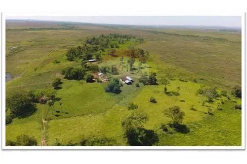
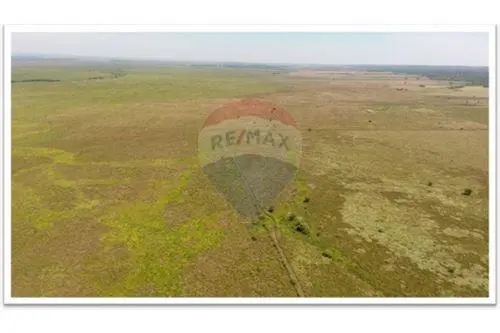
Curupayty Ranch in Arroyos y Esteros. A rural establishment for extensive livestock production on planted pastures and natural grasslands.
Area and layout:
- Total area: 1,185.86 ha.
- Permanent productive area: approximately 800 ha, equivalent to nearly 67% of the property.
- Mechanized area: 135.83 ha (11.45%).
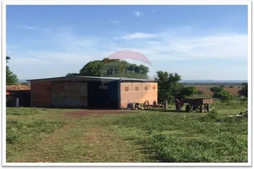
- The northern sector covers 238.33 ha and contains most of the planted pastures, the best infrastructure, the central administrative headquarters, machinery and supply sheds, and the OTISA outpost.
- The southern sector covers 947.53 ha, equivalent to 80% of the total, and has one inactive outpost and one active outpost called Retiro Otto.
Production features:
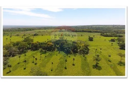
- The northern sector has 135.83 ha of planted Brachiaria brizantha MG5 pastures, distributed among paddocks of varying sizes.
- The southern sector has 92.4 ha of mechanized planted Brachiaria humidicola pastures, divided into three plots of varying sizes and used for grazing and as a protein reserve for critical periods.
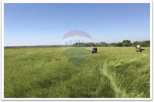
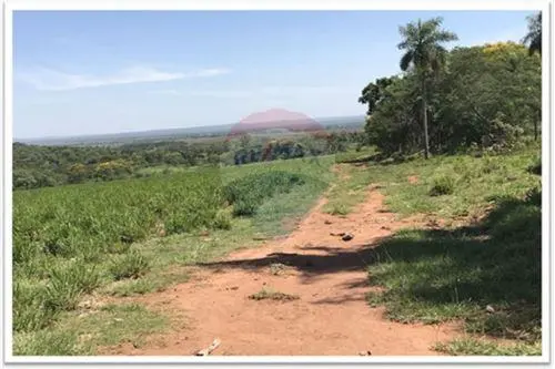
- The southern sector also has 613 ha of meadows, including high and low natural grasslands, mechanized natural grasslands, and planted pastures, which are productive, in very good condition, and mostly weed-free.
- Including the low-lying flood-prone fields, which were completely dry at the time of inspection, the southern sector's grazing area totals 912.19 ha, divided into 16 paddocks of varying sizes.
- The northern sector has 30 paddocks ranging from 1.77 to 20 ha, all with planted Brachiaria brizantha pastures.
- The southern sector has 16 paddocks ranging from 8 to 166.5 ha, mostly with natural meadows. Around Retiro Otto, Brizantha is planted on higher ground, and near Ramal PY03 there are two plots with planted Brachiaria humidicola.
- The entire property has a perimeter fence with 5 strands of wire and posts every 3 meters. Internal fences have 4 or 5 strands, spaced 4 to 6 m apart.
Infrastructure:
- Three distinct administrative areas: the central area and two outposts, one inactive and two active; one of the active outposts is near the Piribebuy River.
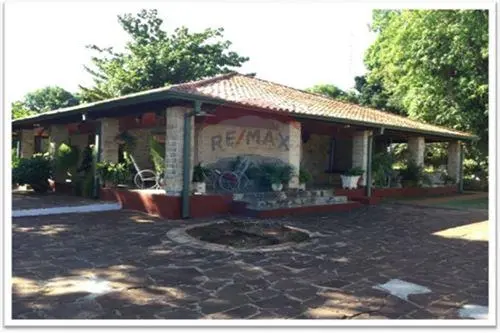
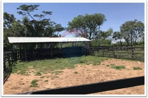
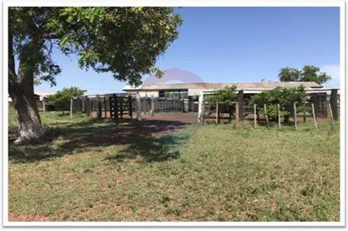
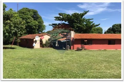
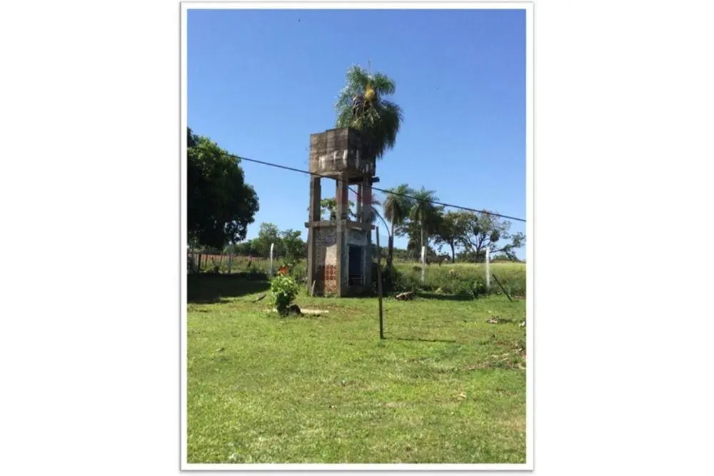
- The central area has the owner's residence, housing for staff and visitors, a main corral, a supply storage building, a machinery shed, a sheep pen, and an artesian well that supplies water for human consumption and livestock troughs.
- The property has infrastructure suited to production.
Water and services:
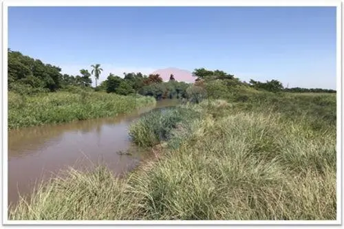
- There are intermittent and permanent waterways in the northeast, with three channels draining toward the southwest. There are also two intermittent channels and one semi-permanent channel near the Piribebuy River, which serves as the property's drainage outlet.
- The area has electricity supplied by ANDE and drinking water supplied by the local Sanitation Board.
- The area is covered by the major mobile phone companies and satellite television services.
Location:
- The ranch is 6.7 km from the urban center of Arroyos y Esteros, with access to healthcare, wholesale and retail businesses, service stations, restaurants, slaughterhouses, banks and financial institutions, educational institutions, metalworking industries, and other businesses related to agricultural production.
- It is near the AGRIPLUS S.A. and VANGUARDIA grain silos.
- Easy access and paved roads provide year-round access.
Surroundings and potential:
- The area supports extensive livestock farming and semi-technified agricultural production. Nearby establishments or those with similar conditions are shifting toward mixed crop-livestock systems, with crops such as rice, soybeans, corn, sorghum, and sugarcane.
- An increase in poultry production has also been observed, mainly broiler chickens, with local unskilled labor being hired.
- The original natural vegetation includes grasslands in the valleys, forest formations in islands and galleries, and woodland vegetation in elevated areas.
- The area is part of the Litoral Central Ecoregion, bordered by the Aquidabán Ecoregion to the north, the Paraguay River to the west, the Selva Central Ecoregion to the east, and the Ñeembucú Ecoregion to the south. It includes the departments of San Pedro, Cordillera, and Central and covers approximately 26,310 km².
- It is a thermo-mesophilic ecoregion with tree groups in groves and irregular, heterogeneous stands alternating with clearings and fields of edaphic or human origin (Tortorelli, 1966). Its forests are transitional between those of Selva Central, Aquidabán, and eastern Chaco. Natural communities include lagoons, marshes, wetlands, forests on saturated soils, rivers, streams, springs, medium and low semi-deciduous forests, and savannas (Vera, 1988, unpublished).
- Common tree species include Sapium haematospernum (Kurupika’y), Phithecellobium scalare (Tataré), Enterolobium contorsiliquum (Timbó), Gleditsia amorphoides (Espina de corona), Erythrina crista-galli (Ceibo), Salix humboltiana (Sauce), and Diplokeleba floribunda (Yvyrá itá).
Terms:
The entire property is offered, including all buildings and planted areas, as well as the machinery, for USD 6950 per ha.
Property details
ID
Category
Type
854878
Farm or field
Sale
Hectares
Code
Updated
1186
J94B4A
2024-10-28
Payment calculator
- Loan
- US$ 5.296.676
- Interest
- US$ 6.140.661
- Total of payments
- US$ 11.437.337
- Down payment
- US$ 2.270.004
Approximate: fixed rate, no insurance or fees. Check the terms with your bank.
Location
Location
Cordillera
Address
Arroyos y Esteros, Arroyos Y Esteros
What's nearby
Straight-line distance, walking time at 4.8 km/h. Map data © OpenStreetMap contributors
Additional Actions
REMAX FIDELITY

Similar object
Sponsored
Sponsored
Operador/a de Marketplace Inmobiliario – Asuncion Estate
We are looking for a Real Estate Marketplace Operator. Remote work full-time.
What is wrong with this listing?
Leave a comment
Verificación de Email
Enter verification code
Code sent to
Agency verification required
REMAX FIDELITY
8036 propiedades
Para verificar la propiedad de este inmueble, debe hacerlo desde la página de la agencia.

Popular search
Location
© 2023-2026 City Estate